
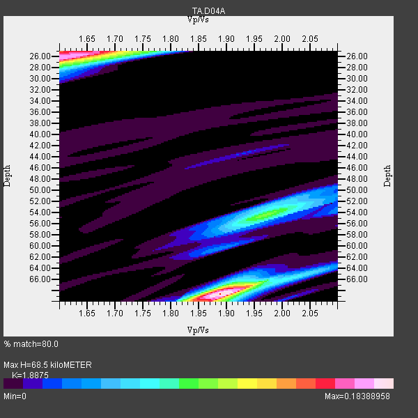
Station TA D04A - Dobbs Creek Ranch, Lacey, WA, USA
Network: TA - USArray Transportable Network (new EarthScope stations)
Nearby stations (2 deg radius)
| Station | Name | (Lat, Lon) | Start / End | Elevation |
| D04A | Dobbs Creek Ranch, Lacey, WA, USA | (47.11, -122.80) | 2005-10-24 / 2499-01-01 | 0.0 km |
| Crust2 Type: | L8,thin continental arc, Cordilleras, 0.5 km seds. |
| Thickness Estimate: | 68 km |
| Thickness StdDev: | 18 km |
| Vp/Vs Estimate: | 1.89 |
| Vp/Vs StdDev: | 0.12 |
| Vs Estimate: | 3.479 km/s |
| Poisson's Ratio: | 0.30 |
| Peak Value: | 0.18 |
| Assumed Vp: | 6.566 km/s |
| Ps Weight: | 0.33333334 |
| PpPs Weight: | 0.33333334 |
| PsPs Weight: | 0.33333328 |
| Residual Complexity: | 0.756 |
| Nearby stations H: | +- |
| (2.0 deg) Vp/Vs: | +- |
1 with match > 90% ( 50.0 %) and 2 with match > 80% ( 100.0 %) out of 2.
Download stack as xyz text file.
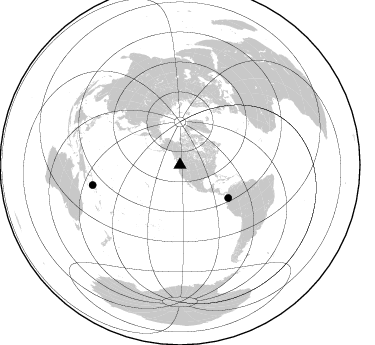
Azimuth Distribution of Events:
Prior Results for this Station
| Study | Thickness | Vp/Vs | Vp | Vs | Poissons Ratio | Extra |
| EARS | 68 km | 1.89 | 6.566 km/s | 3.479 km/s | 0.30 | |
| Crust2.0 | 34 km | 1.77 | 6.566 km/s | 3.707 km/s | 0.27 | L8,thin continental arc, Cordilleras, 0.5 km seds. |
| Global Maxima | 68 km | 1.89 | 6.566 km/s | 3.479 km/s | 0.30 | amp=0.18388958 |
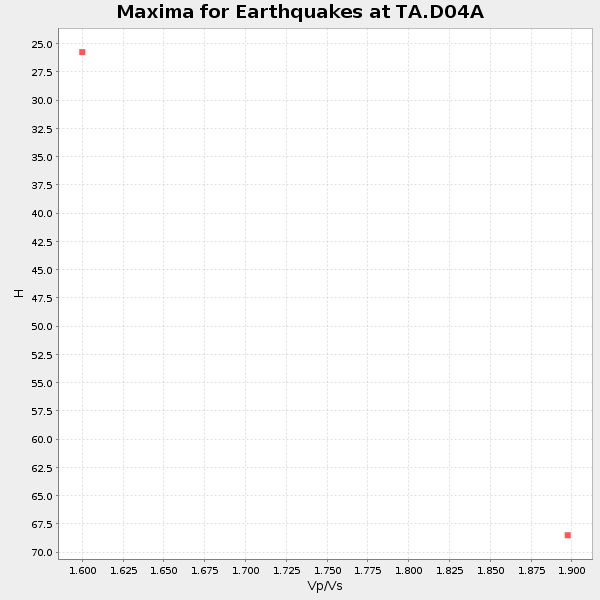
| Local Maxima 1 | 26 km | 1.61 | 6.566 km/s | 4.078 km/s | 0.19 | amp=0.17294791 |
| Local Maxima 2 | 25 km | 1.60 | 6.566 km/s | 4.104 km/s | 0.18 | amp=0.09809324 |
| Local Maxima 3 | 54 km | 1.97 | 6.566 km/s | 3.333 km/s | 0.33 | amp=0.09499728 |
| Local Maxima 4 | 68 km | 1.87 | 6.566 km/s | 3.516 km/s | 0.30 | amp=0.053737108 |
| Predicted Arrivals for vertical incidence (zero ray parameter) | |
| Ps | 9.26 SECOND |
| PpPs | 30.12 SECOND |
| PsPs/PpSs | 39.38 SECOND |
Events Processed for this Station
Download zip of receiver functions as SAC
Plot maxima for each earthquake.
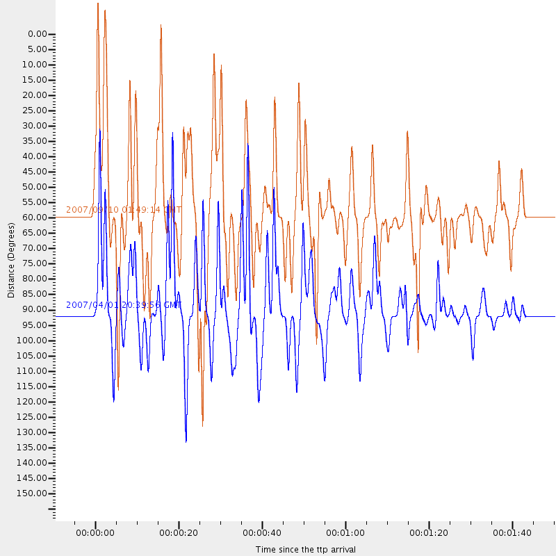
Events Used in the Stack
(2 events)| Radial Match | Distance | Baz | FERegion | Time | Lat/Lon | Depth | Magnitude |
| 92.26459 | 89.5 deg | 257.091 deg | Solomon Islands | 2007/04/01 20:39:56 GMT | (-8.5, 157.0) | 10 km | 6.8 MB, 7.9 MS, 8.1 MW, 7.7 ME |
| 82.728874 | 58.6 deg | 124.389 deg | Near West Coast Of Colombia | 2007/09/10 01:49:14 GMT | (3.0, -78.0) | 31 km | 6.1 MB, 6.7 MS, 6.8 MW |
Losers
(0 events)| Radial Match | Distance | Baz | FERegion | Time | Lat/Lon | Depth | Magnitude | Reason |
