
Station TA P08A - Dixie Valley, NV, USA
Network: TA - USArray Transportable Network (new EarthScope stations)
Nearby stations (2 deg radius)
| Station | Name | (Lat, Lon) | Start / End | Elevation |
| P08A | Dixie Valley, NV, USA | (39.69, -118.08) | 2006-02-26 / 2499-01-01 | 1.0 km |
| Crust2 Type: | M7,medium thick extended crust, 0.5 km seds. |
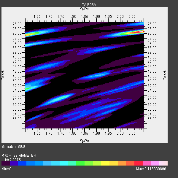
| Thickness Estimate: | 29 km |
| Thickness StdDev: | 11 km |
| Vp/Vs Estimate: | 2.10 |
| Vp/Vs StdDev: | 0.16 |
| Vs Estimate: | 2.993 km/s |
| Poisson's Ratio: | 0.35 |
| Peak Value: | 0.12 |
| Assumed Vp: | 6.279 km/s |
| Ps Weight: | 0.33333334 |
| PpPs Weight: | 0.33333334 |
| PsPs Weight: | 0.33333328 |
| Residual Complexity: | 0.729 |
| Nearby stations H: | +- |
| (2.0 deg) Vp/Vs: | +- |
0 with match > 90% ( 0.0 %) and 3 with match > 80% ( 60.0 %) out of 5.
Download stack as xyz text file.
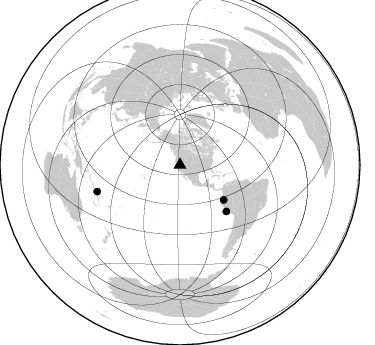
Azimuth Distribution of Events:
Prior Results for this Station
| Study | Thickness | Vp/Vs | Vp | Vs | Poissons Ratio | Extra |
| EARS | 29 km | 2.10 | 6.279 km/s | 2.993 km/s | 0.35 | |
| Crust2.0 | 35 km | 1.78 | 6.279 km/s | 3.533 km/s | 0.27 | M7,medium thick extended crust, 0.5 km seds. |
| Global Maxima | 29 km | 2.10 | 6.279 km/s | 2.993 km/s | 0.35 | amp=0.118339896 |
| Local Maxima 1 | 30 km | 1.60 | 6.279 km/s | 3.918 km/s | 0.18 | amp=0.08933485 |
| Local Maxima 2 | 57 km | 1.75 | 6.279 km/s | 3.583 km/s | 0.26 | amp=0.05109845 |
| Local Maxima 3 | 53 km | 1.62 | 6.279 km/s | 3.882 km/s | 0.19 | amp=0.04337329 |
| Local Maxima 4 | 35 km | 1.60 | 6.279 km/s | 3.924 km/s | 0.18 | amp=0.026823075 |
| Predicted Arrivals for vertical incidence (zero ray parameter) | |
| Ps | 5.07 SECOND |
| PpPs | 14.31 SECOND |
| PsPs/PpSs | 19.38 SECOND |
Events Processed for this Station
Download zip of receiver functions as SAC
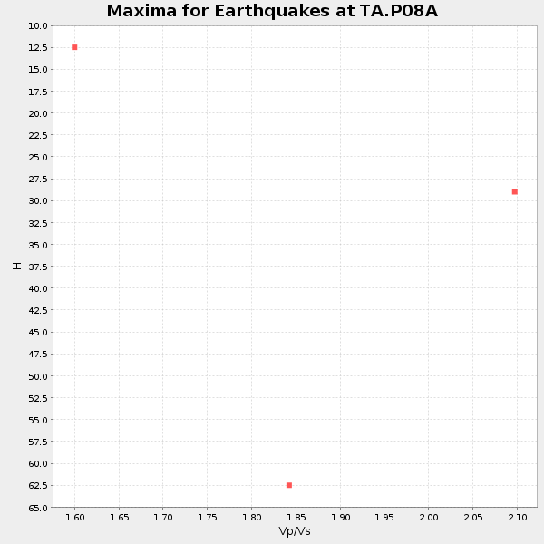
Plot maxima for each earthquake.
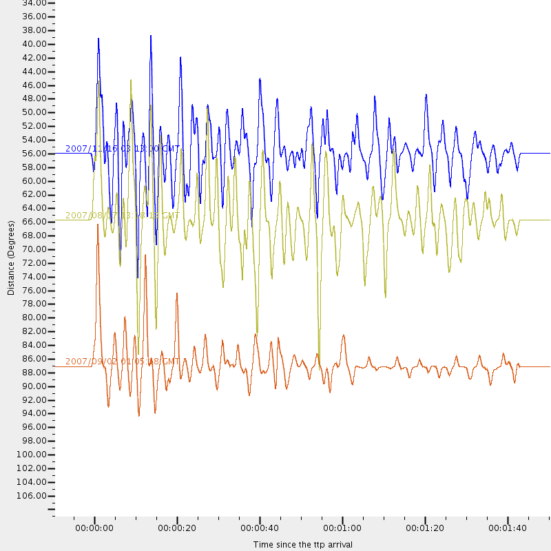
Events Used in the Stack
(3 events)| Radial Match | Distance | Baz | FERegion | Time | Lat/Lon | Depth | Magnitude |
| 83.569786 | 55.7 deg | 128.645 deg | Peru-Ecuador Border Region | 2007/11/16 03:13:00 GMT | (-2.3, -77.8) | 123 km | 6.3 MB, 6.8 MW, 6.7 MW |
| 81.90019 | 65.6 deg | 134.988 deg | Near Coast Of Peru | 2007/08/17 13:18:13 GMT | (-13.6, -76.6) | 48 km | 5.6 MB, 5.6 MS, 5.9 MW |
| 81.36086 | 86.9 deg | 252.312 deg | Santa Cruz Islands | 2007/09/02 01:05:18 GMT | (-11.6, 165.8) | 35 km | 5.9 MB, 7.3 MS, 7.2 MW, 6.9 ME |
Losers
(2 events)| Radial Match | Distance | Baz | FERegion | Time | Lat/Lon | Depth | Magnitude | Reason |
| 56.70038 | 57.6 deg | 312.488 deg | Kamchatka Peninsula, Russia | 2008/03/06 09:38:43 GMT | (51.5, 156.5) | 134 km | 5.6 MB, 5.5 MW, 5.5 MW | |
| 45.35187 | 61.9 deg | 308.352 deg | Kuril Islands | 2008/03/03 09:31:02 GMT | (46.4, 153.2) | 10 km | 6.2 MB, 6.5 MS, 6.5 MW, 6.5 MW |
