
Station XM NM29 - NewMexico29
Network: XM99 - Rio Grande Seismic Transect
Nearby stations (2 deg radius)
| Station | Name | (Lat, Lon) | Start / End | Elevation |
| NM29 | NewMexico29 | (34.65, -106.85) | 1999-07-08 / 2001-12-31 | 1561 m |
| Crust2 Type: | X2,Rift, Rio Grande, Baikal, 0.5km sediments |
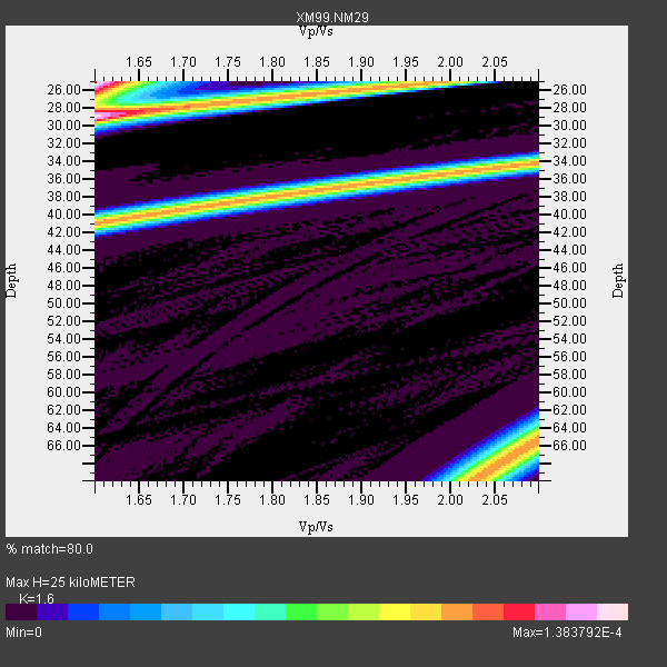
| Thickness Estimate: | 25 km |
| Thickness StdDev: | 7.8 km |
| Vp/Vs Estimate: | 1.60 |
| Vp/Vs StdDev: | 0.19 |
| Vs Estimate: | 4.063 km/s |
| Poisson's Ratio: | 0.18 |
| Peak Value: | 0.00 |
| Assumed Vp: | 6.502 km/s |
| Ps Weight: | 0.33333334 |
| PpPs Weight: | 0.33333334 |
| PsPs Weight: | 0.33333328 |
| Residual Complexity: | 0.964 |
| Nearby stations H: | +- |
| (2.0 deg) Vp/Vs: | +- |
2 with match > 90% ( 40.0 %) and 2 with match > 80% ( 40.0 %) out of 5.
Download stack as xyz text file.
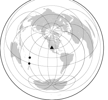
Azimuth Distribution of Events:
Prior Results for this Station
| Study | Thickness | Vp/Vs | Vp | Vs | Poissons Ratio | Extra |
| EARS | 25 km | 1.60 | 6.502 km/s | 4.063 km/s | 0.18 | |
| Crust2.0 | 33 km | 1.77 | 6.502 km/s | 3.68 km/s | 0.26 | X2,Rift, Rio Grande, Baikal, 0.5km sediments |
| Wilson | 37 km | 1.78 | 6.16 km/s | 3.461 km/s | 0.27 | |
| Global Maxima | 25 km | 1.60 | 6.502 km/s | 4.063 km/s | 0.18 | amp=1.383792E-4 |
| Local Maxima 1 | 29 km | 1.60 | 6.502 km/s | 4.063 km/s | 0.18 | amp=1.3413315E-4 |
| Local Maxima 2 | 41 km | 1.61 | 6.502 km/s | 4.044 km/s | 0.18 | amp=1.0136598E-4 |
| Local Maxima 3 | 68 km | 2.05 | 6.502 km/s | 3.179 km/s | 0.34 | amp=9.664968E-5 |
| Local Maxima 4 | 66 km | 2.10 | 6.502 km/s | 3.1 km/s | 0.35 | amp=7.923879E-5 |
| Predicted Arrivals for vertical incidence (zero ray parameter) | |
| Ps | 2.31 SECOND |
| PpPs | 10.00 SECOND |
| PsPs/PpSs | 12.30 SECOND |
Events Processed for this Station
Download zip of receiver functions as SAC
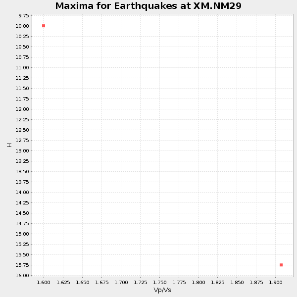
Plot maxima for each earthquake.
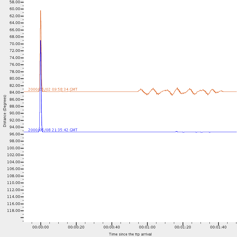
Events Used in the Stack
(2 events)| Radial Match | Distance | Baz | FERegion | Time | Lat/Lon | Depth | Magnitude |
| 99.89942 | 95.2 deg | 235.4 deg | Kermadec Islands Region | 2000/05/08 21:35:42 GMT | (-31.3, 179.8) | 383 km | 5.4 MB, 5.7 MW, 5.6 MW |
| 97.91599 | 83.5 deg | 246.259 deg | Fiji Islands Region | 2000/05/02 09:58:34 GMT | (-15.5, -177.5) | 401 km | 5.3 MB, 5.7 MW |
Losers
(3 events)| Radial Match | Distance | Baz | FERegion | Time | Lat/Lon | Depth | Magnitude | Reason |
| 92.09389 | 32.9 deg | 135.445 deg | Costa Rica | 1999/08/20 10:02:21 GMT | (9.0, -84.2) | 20 km | 6.1 MB, 6.9 MS, 7.0 MW, 6.1 ML | |
| 84.94047 | 46.6 deg | 109.267 deg | Windward Islands | 2000/10/04 14:37:44 GMT | (11.1, -62.6) | 110 km | 5.6 MB, 5.4 MS, 6.1 MW, 5.9 MD | |
| 82.73975 | 76.7 deg | 320.591 deg | Sakhalin, Russia | 2000/08/04 21:13:02 GMT | (48.8, 142.2) | 10 km | 6.3 MB, 7.1 MS, 6.8 MW, 6.7 MW |
