
Station XN HIDE - XN.HIDE
Network: XN00 - RPI-UW Parkfield Calibration Array
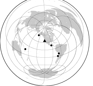
Nearby stations (2 deg radius)
| Station | Name | (Lat, Lon) | Start / End | Elevation |
| HIDE | XN.HIDE | (35.97, -120.55) | 2001-06-24 / 2002-10-15 | 667 m |
| Crust2 Type: | S1,continental slope, margin, transition 1 km seds. |
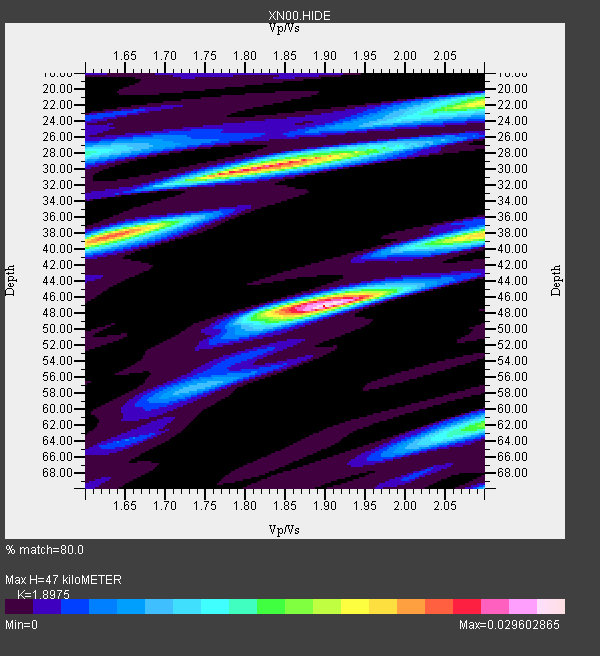
| Thickness Estimate: | 47 km |
| Thickness StdDev: | 9.9 km |
| Vp/Vs Estimate: | 1.90 |
| Vp/Vs StdDev: | 0.15 |
| Vs Estimate: | 3.258 km/s |
| Poisson's Ratio: | 0.31 |
| Peak Value: | 0.03 |
| Assumed Vp: | 6.183 km/s |
| Ps Weight: | 0.33333334 |
| PpPs Weight: | 0.33333334 |
| PsPs Weight: | 0.33333328 |
| Residual Complexity: | 0.790 |
| Nearby stations H: | 29 km +- 9.1 km |
| (2.0 deg) Vp/Vs: | 1.68 +- 0.11 |
0 with match > 90% ( 0.0 %) and 5 with match > 80% ( 71.42857 %) out of 7.
Download stack as xyz text file.
Azimuth Distribution of Events:
Prior Results for this Station
| Study | Thickness | Vp/Vs | Vp | Vs | Poissons Ratio | Extra |
| EARS | 47 km | 1.90 | 6.183 km/s | 3.258 km/s | 0.31 | |
| Crust2.0 | 23 km | 1.81 | 6.183 km/s | 3.422 km/s | 0.28 | S1,continental slope, margin, transition 1 km seds. |
| Global Maxima | 47 km | 1.90 | 6.183 km/s | 3.258 km/s | 0.31 | amp=0.029602865 |
| Local Maxima 1 | 30 km | 1.83 | 6.183 km/s | 3.388 km/s | 0.29 | amp=0.026427777 |
| Local Maxima 2 | 38 km | 1.63 | 6.183 km/s | 3.787 km/s | 0.20 | amp=0.022005655 |
| Local Maxima 3 | 22 km | 2.10 | 6.183 km/s | 2.948 km/s | 0.35 | amp=0.01593139 |
| Local Maxima 4 | 62 km | 2.10 | 6.183 km/s | 2.948 km/s | 0.35 | amp=0.015336875 |
| Predicted Arrivals for vertical incidence (zero ray parameter) | |
| Ps | 6.82 SECOND |
| PpPs | 22.03 SECOND |
| PsPs/PpSs | 28.85 SECOND |
Events Processed for this Station
Download zip of receiver functions as SAC
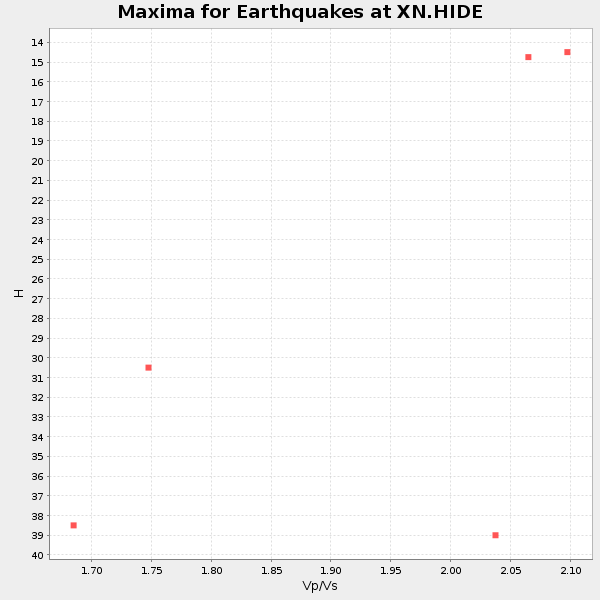
Plot maxima for each earthquake.
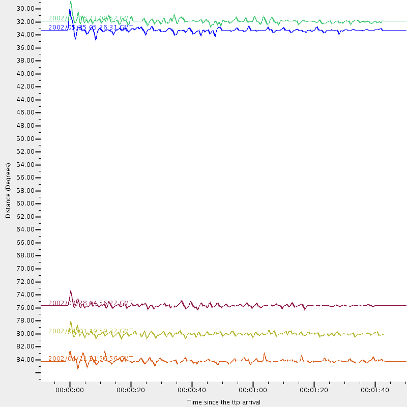
Events Used in the Stack
(5 events)| Radial Match | Distance | Baz | FERegion | Time | Lat/Lon | Depth | Magnitude |
| 88.5513 | 33.3 deg | 315.31 deg | South Of Alaska | 2002/05/25 05:36:31 GMT | (53.8, -161.1) | 33 km | 5.5 MB, 6.1 MS, 6.5 MW, 6.4 MW |
| 88.14711 | 31.8 deg | 122.696 deg | Near Coast Of Chiapas, Mexico | 2002/01/16 23:09:52 GMT | (15.5, -93.1) | 80 km | 5.8 MB, 6.4 MW, 6.4 MW |
| 87.24648 | 84.2 deg | 247.689 deg | Vanuatu Islands | 2002/04/11 21:56:56 GMT | (-14.4, 167.7) | 10 km | 5.9 MB, 6.2 MS, 6.2 MW, 6.1 MW |
| 86.90623 | 75.7 deg | 130.636 deg | Chile-Bolivia Border Region | 2002/03/28 04:56:22 GMT | (-21.7, -68.3) | 125 km | 6.1 MB, 6.5 MW, 6.5 MW |
| 80.46109 | 80.0 deg | 138.038 deg | Near Coast Of Central Chile | 2002/04/01 19:59:32 GMT | (-29.7, -71.4) | 71 km | 6.1 MB, 6.4 MW, 6.4 MW |
Losers
(2 events)| Radial Match | Distance | Baz | FERegion | Time | Lat/Lon | Depth | Magnitude | Reason |
| 100.0 | 82.0 deg | 134.454 deg | Catamarca Province, Argentina | 2002/05/28 04:04:22 GMT | (-28.9, -66.8) | 22 km | 6.0 MB, 5.7 MS, 6.0 MW, 5.9 MW | |
| 56.25269 | 76.8 deg | 236.22 deg | Fiji Islands Region | 2002/05/04 07:00:48 GMT | (-17.9, -178.7) | 560 km | 5.3 MB, 5.8 MW, 5.7 MW |
