
Station GS OK047 - Pawnee, OK, Station 47
Network: GS - US Geological Survey Networks
Nearby stations (2 deg radius)
| Station | Name | (Lat, Lon) | Start / End | Elevation |
| OK047 | Pawnee, OK, Station 47 | (36.47, -96.72) | 2016-09-07 / 2599-12-31 | 253 m |
| Crust2 Type: | D5,thick Platform 2 km seds. |
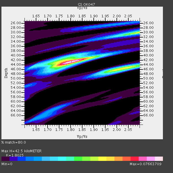
| Thickness Estimate: | 42 km |
| Thickness StdDev: | 1.0 km |
| Vp/Vs Estimate: | 1.80 |
| Vp/Vs StdDev: | 0.03 |
| Vs Estimate: | 3.596 km/s |
| Poisson's Ratio: | 0.28 |
| Peak Value: | 0.08 |
| Assumed Vp: | 6.483 km/s |
| Ps Weight: | 0.33333334 |
| PpPs Weight: | 0.33333334 |
| PsPs Weight: | 0.33333328 |
| Residual Complexity: | 0.631 |
| Nearby stations H: | +- |
| (2.0 deg) Vp/Vs: | +- |
1 with match > 90% ( 33.333332 %) and 2 with match > 80% ( 66.666664 %) out of 3.
Download stack as xyz text file.
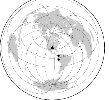
Azimuth Distribution of Events:
Prior Results for this Station
| Study | Thickness | Vp/Vs | Vp | Vs | Poissons Ratio | Extra |
| EARS | 42 km | 1.80 | 6.483 km/s | 3.596 km/s | 0.28 | |
| Crust2.0 | 46 km | 1.78 | 6.483 km/s | 3.648 km/s | 0.27 | D5,thick Platform 2 km seds. |
| Global Maxima | 42 km | 1.80 | 6.483 km/s | 3.596 km/s | 0.28 | amp=0.07663709 |
| Local Maxima 1 | 46 km | 2.02 | 6.483 km/s | 3.205 km/s | 0.34 | amp=0.051511593 |
| Local Maxima 2 | 30 km | 2.10 | 6.483 km/s | 3.091 km/s | 0.35 | amp=0.04721057 |
| Local Maxima 3 | 42 km | 1.75 | 6.483 km/s | 3.704 km/s | 0.26 | amp=0.026529307 |
| Local Maxima 4 | 46 km | 1.73 | 6.483 km/s | 3.758 km/s | 0.25 | amp=0.018686652 |
| Predicted Arrivals for vertical incidence (zero ray parameter) | |
| Ps | 5.26 SECOND |
| PpPs | 18.37 SECOND |
| PsPs/PpSs | 23.63 SECOND |
Events Processed for this Station
Download zip of receiver functions as SAC
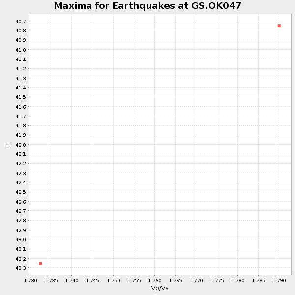
Plot maxima for each earthquake.
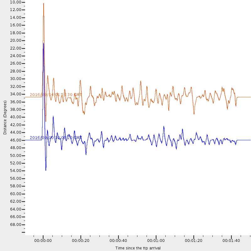
Events Used in the Stack
(2 events)| Radial Match | Distance | Baz | FERegion | Time | Lat/Lon | Depth | Magnitude |
| 95.21081 | 45.7 deg | 151.978 deg | Northern Peru | 2016/09/10 10:08:20 GMT | (-5.6, -77.0) | 114 km | 6.0 MB |
| 80.51002 | 34.6 deg | 142.005 deg | Northern Colombia | 2016/09/14 01:58:30 GMT | (7.3, -76.1) | 10 km | 5.9 MWP |
Losers
(1 events)| Radial Match | Distance | Baz | FERegion | Time | Lat/Lon | Depth | Magnitude | Reason |
| 61.762802 | 73.5 deg | 152.678 deg | Cordoba Province, Argentina | 2016/09/09 00:03:43 GMT | (-31.4, -65.7) | 151 km | 5.6 MWR |

