
Station XM TX02 - Texas02
Network: XM99 - Rio Grande Seismic Transect
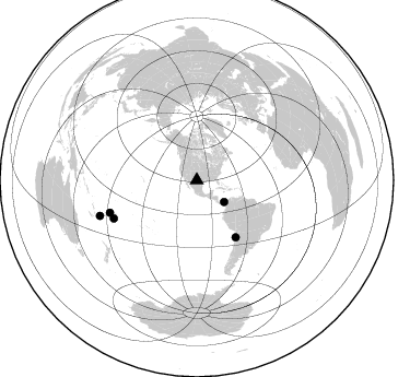
Nearby stations (2 deg radius)
| Station | Name | (Lat, Lon) | Start / End | Elevation |
| TX02 | Texas02 | (31.51, -103.20) | 1999-09-11 / 2001-12-31 | 765 m |
| Crust2 Type: | Q1,orogen/39km no ice, Appalachians, North Andes |
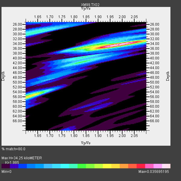
| Thickness Estimate: | 34 km |
| Thickness StdDev: | 9.4 km |
| Vp/Vs Estimate: | 1.99 |
| Vp/Vs StdDev: | 0.16 |
| Vs Estimate: | 3.083 km/s |
| Poisson's Ratio: | 0.33 |
| Peak Value: | 0.04 |
| Assumed Vp: | 6.121 km/s |
| Ps Weight: | 0.33333334 |
| PpPs Weight: | 0.33333334 |
| PsPs Weight: | 0.33333328 |
| Residual Complexity: | 0.568 |
| Nearby stations H: | +- |
| (2.0 deg) Vp/Vs: | +- |
0 with match > 90% ( 0.0 %) and 5 with match > 80% ( 62.5 %) out of 8.
Download stack as xyz text file.
Azimuth Distribution of Events:
Prior Results for this Station
| Study | Thickness | Vp/Vs | Vp | Vs | Poissons Ratio | Extra |
| EARS | 34 km | 1.99 | 6.121 km/s | 3.083 km/s | 0.33 | |
| Crust2.0 | 39 km | 1.76 | 6.121 km/s | 3.485 km/s | 0.26 | Q1,orogen/39km no ice, Appalachians, North Andes |
| Wilson | 44 km | 1.75 | 6.3 km/s | 3.6 km/s | 0.26 | |
| Global Maxima | 34 km | 1.99 | 6.121 km/s | 3.083 km/s | 0.33 | amp=0.035695195 |
| Local Maxima 1 | 55 km | 1.63 | 6.121 km/s | 3.755 km/s | 0.20 | amp=0.02095484 |
| Local Maxima 2 | 30 km | 1.62 | 6.121 km/s | 3.79 km/s | 0.19 | amp=0.015834896 |
| Local Maxima 3 | 35 km | 1.86 | 6.121 km/s | 3.286 km/s | 0.30 | amp=0.015588072 |
| Local Maxima 4 | 40 km | 1.82 | 6.121 km/s | 3.363 km/s | 0.28 | amp=0.010917497 |
| Predicted Arrivals for vertical incidence (zero ray parameter) | |
| Ps | 5.51 SECOND |
| PpPs | 16.70 SECOND |
| PsPs/PpSs | 22.22 SECOND |
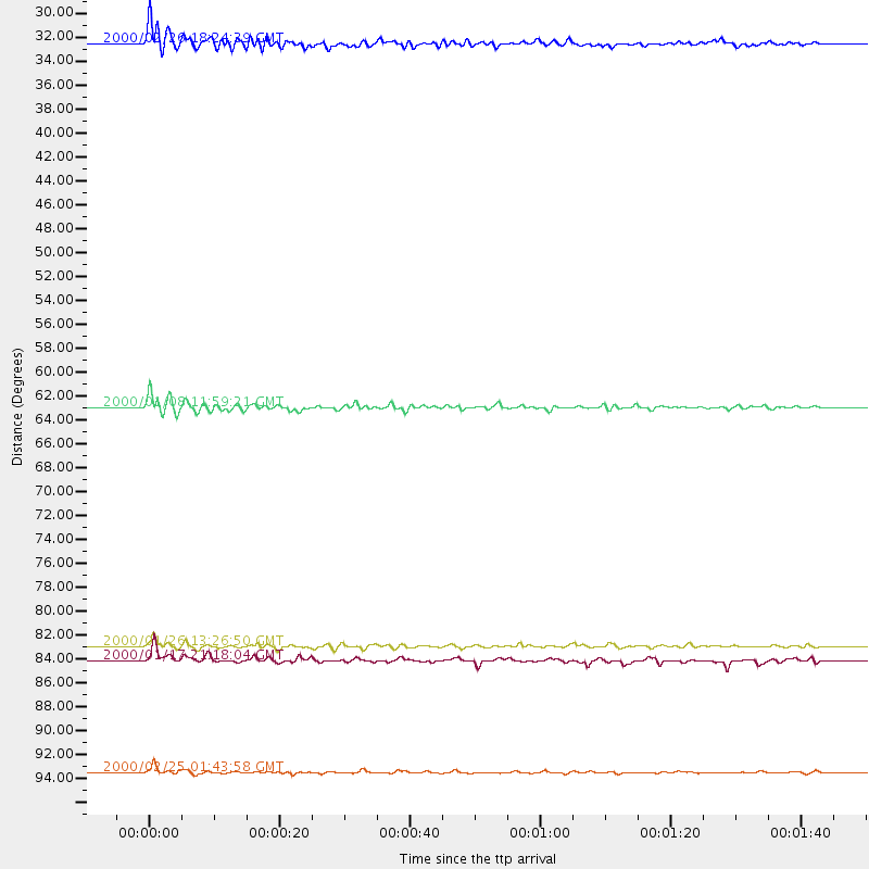
Events Processed for this Station
Download zip of receiver functions as SAC
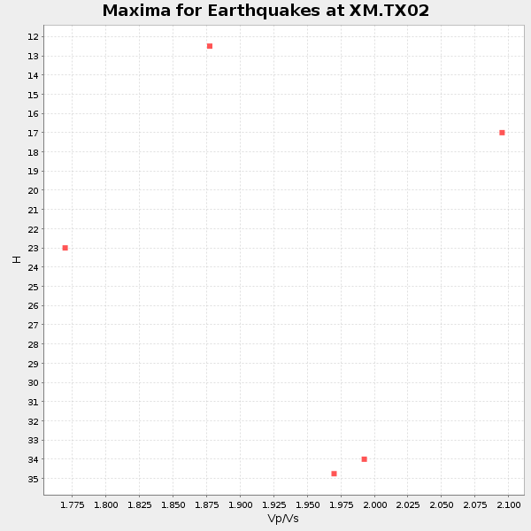
Plot maxima for each earthquake.
Events Used in the Stack
(5 events)| Radial Match | Distance | Baz | FERegion | Time | Lat/Lon | Depth | Magnitude |
| 85.30385 | 62.9 deg | 145.657 deg | Near Coast Of Northern Chile | 2000/01/08 11:59:21 GMT | (-23.2, -70.1) | 36 km | 5.8 MB, 5.9 MS, 6.4 MW, 6.1 ME |
| 84.98594 | 83.4 deg | 245.275 deg | Tonga Islands | 2000/01/26 13:26:50 GMT | (-17.3, -174.0) | 33 km | 5.9 MB, 6.0 MS, 6.4 MW, 6.3 MW |
| 81.45083 | 31.8 deg | 128.508 deg | Panama | 2000/02/26 18:24:39 GMT | (9.4, -78.5) | 65 km | 5.8 MB, 5.4 MS, 6.2 MW, 6.1 MW |
| 81.34643 | 84.7 deg | 249.529 deg | Fiji Islands Region | 2000/01/17 21:18:04 GMT | (-14.5, -177.6) | 33 km | 5.6 MB, 5.7 MS, 5.9 MW, 5.8 MW |
| 81.23722 | 94.3 deg | 249.835 deg | Vanuatu Islands Region | 2000/02/25 01:43:58 GMT | (-19.5, 173.8) | 33 km | 6.1 MB, 7.1 MS, 7.1 MW, 7.0 MW |
Losers
(3 events)| Radial Match | Distance | Baz | FERegion | Time | Lat/Lon | Depth | Magnitude | Reason |
| 96.3472 | 96.5 deg | 300.98 deg | Volcano Islands, Japan Region | 2000/03/28 11:00:22 GMT | (22.3, 143.7) | 126 km | 6.8 MB, 7.6 MS, 7.6 MW, 7.6 MW | |
| 84.6201 | 92.6 deg | 316.68 deg | Sea Of Japan | 2000/06/06 21:16:42 GMT | (36.8, 135.5) | 10 km | 5.7 MB, 5.3 MS, 5.9 MW, 5.8 MW | |
| 81.73175 | 89.5 deg | 313.507 deg | Near East Coast Of Honshu, Japan | 2000/07/20 18:39:18 GMT | (36.5, 141.0) | 47 km | 6.1 MB, 5.4 MS, 6.1 ME, 6.0 MW |
