
Station YF HVAR - YF.HVAR
Network: YF99 - Midsea - Mantle Investigation of the Deep Suture between Eurasia and Africa
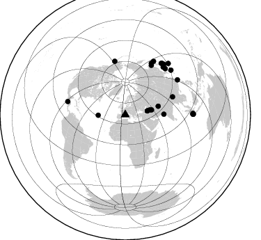
Nearby stations (2 deg radius)

| Station | Name | (Lat, Lon) | Start / End | Elevation |
| HVAR | YF.HVAR | (43.18, 6.45) | 1999-10-13 / 2001-12-31 | 0.2 km |
| Crust2 Type: | BB,melt affected o.c. and oceanic plateaus, 3 km seds. |
| Thickness Estimate: | 43 km |
| Thickness StdDev: | 10 km |
| Vp/Vs Estimate: | 1.71 |
| Vp/Vs StdDev: | 0.15 |
| Vs Estimate: | 3.165 km/s |
| Poisson's Ratio: | 0.24 |
| Peak Value: | 0.02 |
| Assumed Vp: | 5.405 km/s |
| Ps Weight: | 0.33333334 |
| PpPs Weight: | 0.33333334 |
| PsPs Weight: | 0.33333328 |
| Residual Complexity: | 0.784 |
| Nearby stations H: | +- |
| (2.0 deg) Vp/Vs: | +- |
17 with match > 90% ( 68.0 %) and 25 with match > 80% ( 100.0 %) out of 25.
Download stack as xyz text file.
Azimuth Distribution of Events:
Prior Results for this Station
| Study | Thickness | Vp/Vs | Vp | Vs | Poissons Ratio | Extra |
| EARS | 43 km | 1.71 | 5.405 km/s | 3.165 km/s | 0.24 | |
| Crust2.0 | 22 km | 1.91 | 5.405 km/s | 2.827 km/s | 0.31 | BB,melt affected o.c. and oceanic plateaus, 3 km seds. |
| Global Maxima | 43 km | 1.71 | 5.405 km/s | 3.165 km/s | 0.24 | amp=0.01727895 |
| Local Maxima 1 | 17 km | 2.10 | 5.405 km/s | 2.577 km/s | 0.35 | amp=0.016184032 |
| Local Maxima 2 | 32 km | 1.91 | 5.405 km/s | 2.826 km/s | 0.31 | amp=0.013510365 |
| Local Maxima 3 | 44 km | 1.73 | 5.405 km/s | 3.129 km/s | 0.25 | amp=0.011285868 |
| Local Maxima 4 | 32 km | 1.61 | 5.405 km/s | 3.367 km/s | 0.18 | amp=0.010478464 |
| Predicted Arrivals for vertical incidence (zero ray parameter) | |
| Ps | 5.66 SECOND |
| PpPs | 21.67 SECOND |
| PsPs/PpSs | 27.33 SECOND |
Events Processed for this Station
Download zip of receiver functions as SAC
Plot maxima for each earthquake.
Events Used in the Stack
(25 events)| Radial Match | Distance | Baz | FERegion | Time | Lat/Lon | Depth | Magnitude |
| 97.979774 | 84.9 deg | 282.955 deg | El Salvador | 2001/01/13 17:33:32 GMT | (13.0, -88.7) | 60 km | 6.4 MB, 7.8 MS, 7.7 MW, 7.5 ME |
| 97.963 | 55.5 deg | 89.137 deg | Southern India | 2001/01/26 03:16:40 GMT | (23.4, 70.2) | 16 km | 6.9 MB, 8.0 MS, 7.7 MW, 7.7 ME |
| 97.82115 | 72.7 deg | 69.325 deg | Myanmar | 2000/06/07 21:46:55 GMT | (26.9, 97.2) | 33 km | 6.3 MB, 6.5 MS, 6.4 MW, 6.4 MW |
| 96.54701 | 97.3 deg | 89.598 deg | Southern Sumatra, Indonesia | 2000/06/04 16:28:26 GMT | (-4.7, 102.1) | 33 km | 6.8 MB, 8.0 MS, 7.9 MW, 7.7 MW |
| 96.398735 | 48.9 deg | 75.624 deg | Hindu Kush Region, Afghanistan | 2000/05/12 23:10:29 GMT | (36.0, 70.7) | 108 km | 6.2 MB, 6.3 MW, 6.3 MW |
| 96.33545 | 78.7 deg | 348.838 deg | Kodiak Island Region, Alaska | 2001/01/10 16:02:44 GMT | (57.1, -153.2) | 33 km | 6.2 MB, 6.8 MS, 7.1 MW, 6.8 ML |
| 95.09727 | 90.4 deg | 56.242 deg | Taiwan | 2000/06/10 18:23:29 GMT | (23.8, 121.2) | 33 km | 6.2 MB, 6.2 MS, 6.4 MW, 6.3 MW |
| 94.25954 | 87.1 deg | 27.905 deg | Kuril Islands | 2000/01/28 14:21:07 GMT | (43.0, 146.8) | 61 km | 6.7 MB, 6.6 MS, 6.8 MW, 6.8 ME |
| 94.12837 | 80.5 deg | 27.871 deg | Sakhalin, Russia | 2000/08/04 21:13:02 GMT | (48.8, 142.2) | 10 km | 6.3 MB, 7.1 MS, 6.8 MW, 6.7 MW |
| 93.8712 | 38.9 deg | 269.058 deg | Northern Mid-Atlantic Ridge | 2000/10/05 13:39:11 GMT | (31.7, -41.0) | 10 km | 5.4 MB, 6.1 MS, 6.0 MW, 5.9 MW |
| 93.87083 | 97.1 deg | 89.642 deg | Southern Sumatra, Indonesia | 2000/06/07 23:45:26 GMT | (-4.6, 101.9) | 33 km | 6.1 MB, 6.7 MS, 6.7 MW, 6.5 MW |
| 93.723885 | 98.0 deg | 89.454 deg | Southern Sumatra, Indonesia | 2000/06/06 09:58:06 GMT | (-5.1, 102.7) | 33 km | 5.8 MB, 6.1 MS, 6.2 MW, 6.1 MW |
| 92.97542 | 91.9 deg | 45.665 deg | Southeast Of Ryukyu Islands | 2000/06/06 14:57:02 GMT | (29.4, 131.4) | 33 km | 5.8 MB, 6.0 MS, 6.4 MW, 6.4 MW |
| 92.76289 | 36.1 deg | 78.85 deg | Turkmenistan | 2000/12/06 17:11:06 GMT | (39.6, 54.8) | 30 km | 6.7 MB, 7.5 MS, 7.0 MW, 6.9 ME |
| 92.65634 | 87.9 deg | 38.598 deg | Sea Of Japan | 2000/06/06 21:16:42 GMT | (36.8, 135.5) | 10 km | 5.7 MB, 5.3 MS, 5.9 MW, 5.8 MW |
| 91.965454 | 96.4 deg | 40.122 deg | Bonin Islands, Japan Region | 2000/08/06 07:27:12 GMT | (28.9, 139.6) | 395 km | 6.3 MB, 7.3 MW, 7.3 MW |
| 90.71759 | 87.9 deg | 40.93 deg | Western Honshu, Japan | 2000/10/06 04:30:19 GMT | (35.5, 133.1) | 10 km | 5.8 MB, 6.8 MS, 7.0 ME, 6.7 MW |
| 88.68009 | 91.7 deg | 37.547 deg | Near S. Coast Of Honshu, Japan | 2000/07/01 07:01:55 GMT | (34.2, 139.1) | 10 km | 6.0 MB, 6.1 MS, 6.2 MW, 6.2 MW |
| 87.74599 | 97.1 deg | 88.927 deg | Southern Sumatra, Indonesia | 2000/07/22 20:56:12 GMT | (-4.1, 102.4) | 69 km | 5.8 MB, 5.8 MW, 5.7 MW |
| 87.11701 | 91.1 deg | 35.912 deg | Near East Coast Of Honshu, Japan | 2000/06/03 08:54:49 GMT | (35.6, 140.5) | 62 km | 5.6 MB, 5.6 MS, 6.1 MW, 6.1 MW |
| 86.72419 | 32.3 deg | 80.076 deg | Eastern Caucasus | 2000/11/25 18:09:11 GMT | (40.2, 49.9) | 50 km | 5.8 MB, 6.3 MW |
| 85.53352 | 32.4 deg | 80.209 deg | Eastern Caucasus | 2000/11/25 18:10:47 GMT | (40.2, 50.0) | 33 km | 6.2 MB, 6.3 MS, 6.3 MW, 6.2 ME |
| 84.20091 | 38.5 deg | 79.753 deg | Turkmenistan-Iran Border Region | 2000/08/22 16:55:13 GMT | (38.1, 57.4) | 10 km | 5.2 MB, 5.8 MS, 5.8 MW, 5.7 MW |
| 83.65786 | 90.5 deg | 35.052 deg | Near East Coast Of Honshu, Japan | 2000/07/20 18:39:18 GMT | (36.5, 141.0) | 47 km | 6.1 MB, 5.4 MS, 6.1 ME, 6.0 MW |
| 80.00617 | 83.3 deg | 26.989 deg | Sea Of Okhotsk | 2000/07/10 09:58:18 GMT | (46.8, 145.4) | 360 km | 6.1 MB, 5.9 MW, 5.8 MW |
Losers
(0 events)| Radial Match | Distance | Baz | FERegion | Time | Lat/Lon | Depth | Magnitude | Reason |
